One Operator, Many Robots: UAV–UGV teams for search and rescue
Imagine a rescue mission in a large, unstructured area: you need to cover ground fast, find anyone who might be lying there, and get help to them quickly. Now imagine doing all of that with a single person giving voice commands to a whole team of drones and one ground robot — no joysticks, no programming, no control room full of specialists.
That's the vision behind our latest work, One Operator, Many Robots: Natural-Language Command of UAV–UGV Teams for Search, Victim Detection, and Rescue, accepted at IEEE SSRR 2026. It builds directly on Swarm-Steward and takes it one crucial step further: connecting what the drones see with what the ground robot does.
Figure 1 shows the end-to-end workflow demonstrated in the field: (a) natural-language mission control, (b) multi-UAV aerial search and victim localization, and (c) UGV deployment toward the confirmed victim location.
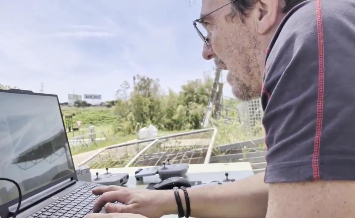
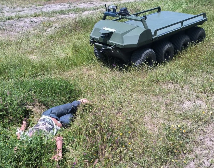
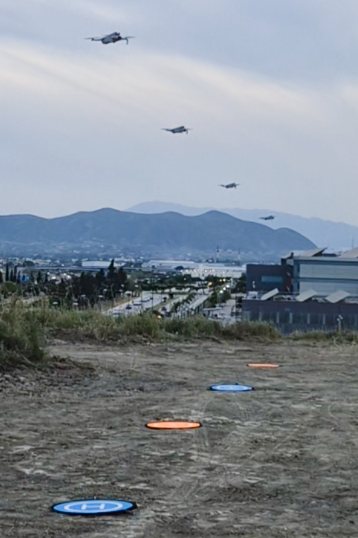
From aerial search to ground response
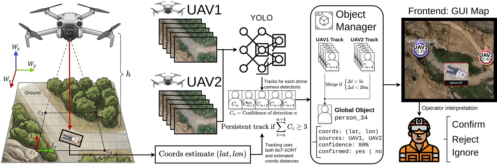
Search-and-rescue operations require rapid area coverage, reliable victim localization, and fast deployment of response assets — but connecting aerial perception with ground-robot action remains difficult for non-expert operators. During autonomous lawnmower-style search, DJI Mini 4 Pro UAVs stream video and telemetry to a perception pipeline that applies a YOLO26l aerial person detector, tracks detections over time, and projects candidate victims to ground coordinates using UAV pose, gimbal state, camera geometry, and terrain elevation.
Figure 2 shows the full victim-detection and cross-UAV association pipeline: detections in sampled frames are geolocated from telemetry and terrain elevation, accumulated into per-UAV tracks, associated across UAVs by the Object Manager, and surfaced to the operator as candidate objects that can be confirmed, rejected, or allowed to expire.
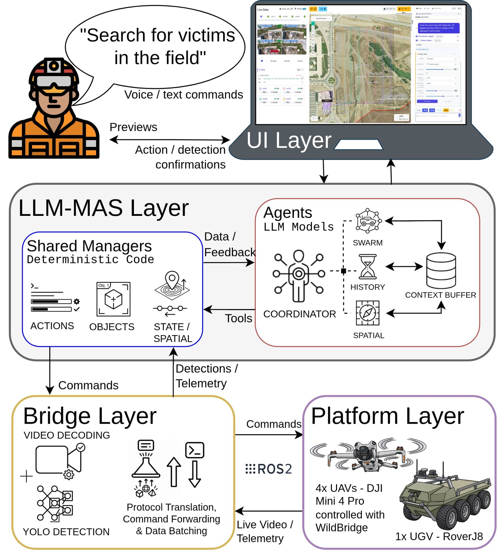
Accepted tracks are surfaced on the mission map as dynamic entities that the operator can confirm or reject — and once confirmed, they can be referenced in follow-up natural-language commands, for example to send a UAV to monitor the victim or to dispatch the UGV toward a nearby rescue position. Figure 3 shows the extended architecture: the UI layer supports natural-language commands, previews, and confirmations; the LLM-MAS layer coordinates agents and deterministic managers; the bridge layer performs protocol translation, video decoding, detection, and data batching; and the platform layer contains the UAV and UGV robots.
Training the aerial person detector
Because aerial person detection at these altitudes is different from ground-level detection, we trained a custom YOLO26l model on a merged set of four aerial-person datasets — SARD, HERIDAL, LaDD, and NOMAD — summarized in Table 1.
| Dataset | Orig. imgs | Used | Val. imgs | Selection / preprocessing |
|---|---|---|---|---|
| SARD | 1,183 | 1,000 | 200 | Person-like classes collapsed to person; largest avg bbox area preferred |
| HERIDAL | 1,546 | ~985 | 197 | CSV labels converted to YOLO; largest avg bbox area preferred |
| LaDD | 1,220 | 1,000 | 200 | COCO labels converted to YOLO; largest avg bbox area preferred |
| NOMAD | 20,752 | 1,000 | 200 | Altitude-stratified 10/30/50 m sampling with round-robin actor selection |
Four aerial-person datasets merged and relabeled to a common person class (~4,000 training images).
Table 2 shows the retrospective model sweep on the balanced validation split. YOLO26l reached mAP50 = 0.832 and mAP50–95 = 0.501, the best of the whole sweep while avoiding the larger checkpoint of YOLO26x — see Table 2. Inference runs on the ground station (RTX 5090), so throughput was never the bottleneck in the field.
| Model | mAP50 | mAP50–95 | Inference (ms/image) | Checkpoint (MiB) |
|---|---|---|---|---|
| YOLO26n | 0.774 | 0.412 | 1.91 | 5.1 |
| YOLO26s | 0.823 | 0.467 | 2.04 | 19.4 |
| YOLO26m | 0.819 | 0.487 | 3.92 | 42.0 |
| YOLO26l (chosen) | 0.832 | 0.501 | 4.48 | 50.5 |
| YOLO26x | 0.814 | 0.500 | 8.95 | 112.8 |
YOLO26l achieved the best mAP50–95 (0.501) while avoiding the larger checkpoint of YOLO26x. Inference time is the image-weighted mean over the source-validation runs on the ground-station laptop (NVIDIA RTX 5090), excluding preprocessing, video transport, and tracking.
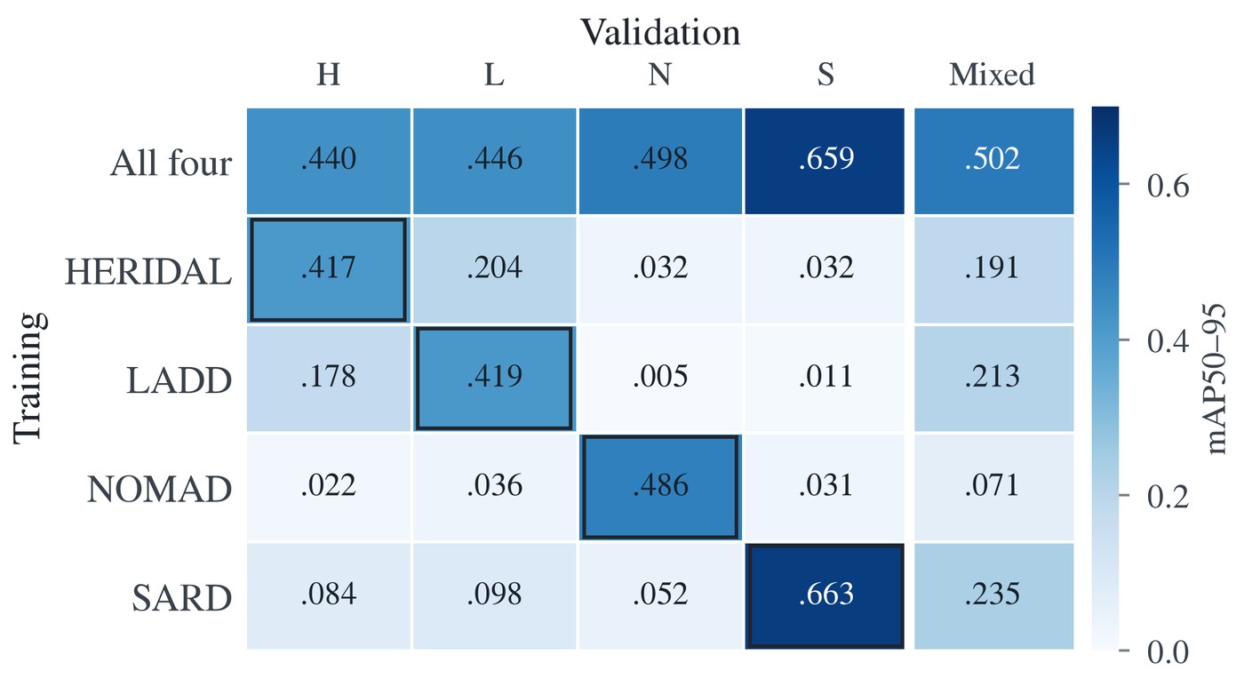
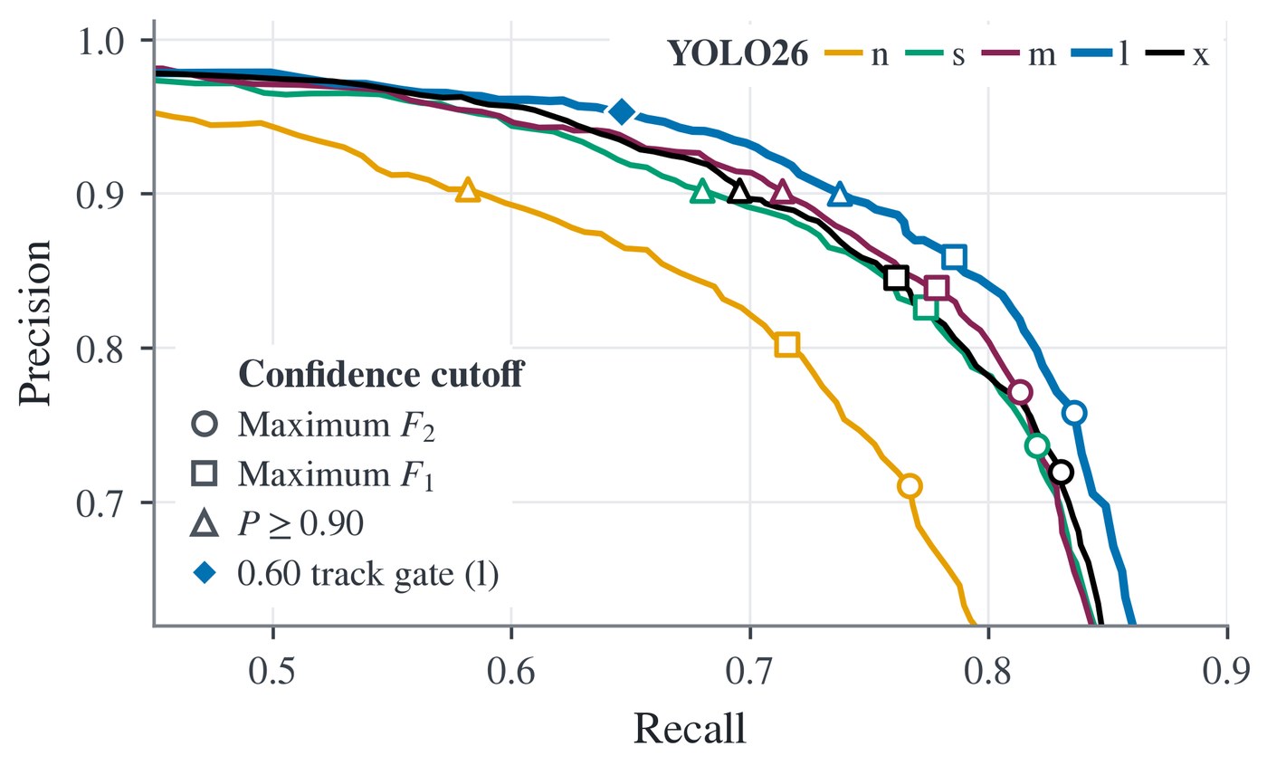
The camera-ready version adds two detector analyses: how the combined model compares against single-dataset specialists, and where the detector's precision–recall operating points land for each model size.
Twelve outdoor experiments
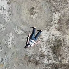
We evaluated the system in 12 outdoor experiments over an approximately 48,000 m² unstructured area, covering four victim placements, one-, two-, and four-UAV teams, different gimbal angles, and search speeds. Figure 4 shows the search area, the planned lawnmower sweeps, and drone-view examples of the four victim placements (a–d), with the full search area and sweep plan below.
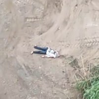
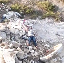
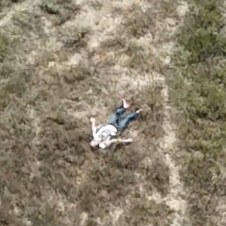
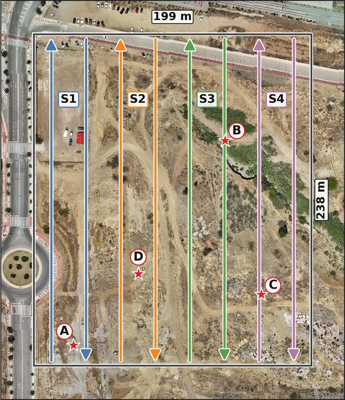
Three placements produced successful detections with best mean localization errors of 1.21 m, 2.29 m, and 1.92 m; the fourth placement (location C) remained unresolved — the body position and background were challenging even for the human eye, and the runs lacked a reliable reference for localization scoring. Table 3 reports the representative outcomes per scenario.
| Scenario (Loc./N) | Speed (m/s) | Gimbal | Detector | Alt. (m) | Track det. | Mean err. (m) | Mean conf. |
|---|---|---|---|---|---|---|---|
| A / 1 | 2 | −90° | mini4 | 35 | 18 | 1.21 ± 0.58 | 0.67 ± 0.18 |
| A / 2 | 2 | −90° | mini2 | 40 | 50 | 1.99 ± 0.78 | 0.52 ± 0.12 |
| A / 4 | 2 | −90° | mini3 | 45 | 15 | 2.41 ± 0.51 | 0.73 ± 0.11 |
| B / 1 | 4 | −45° | mini4 | 35 | 38 | 8.80 ± 1.46 | 0.74 ± 0.14 |
| B / 2 | 4 | −45° | mini2 | 40 | 10 | 7.09 ± 1.25 | 0.60 ± 0.14 |
| B / 4 | 2 | −90° | mini2 | 40 | 34 | 2.29 ± 0.29 | 0.67 ± 0.14 |
| C / 4 | 4 | −90° | — | — | — | — | — |
| C / 4 | 4 | −45° | — | — | — | — | — |
| D / 1 | 4 | −45° | mini1 | 35 | 17 | 9.33 ± 0.56 | 0.66 ± 0.13 |
| D / 2 | 4 | −45° | mini2 | 40 | 12 | 3.13 ± 0.76 | 0.65 ± 0.16 |
| D / 4 | 4 | −45° | mini3 | 45 | 9 | 1.92 ± 0.06 | 0.47 ± 0.14 |
| D / 1 | 4 | −90° | mini1 | 80 | 47 | 6.37 ± 2.85 | 0.66 ± 0.13 |
Locations A, B, D localized within 10 m; location C (difficult placement) was not localized. A / 1 and B / 1 at 35 m used mini4; D / 1 at 80 m used mini1.
From detection to rescue response
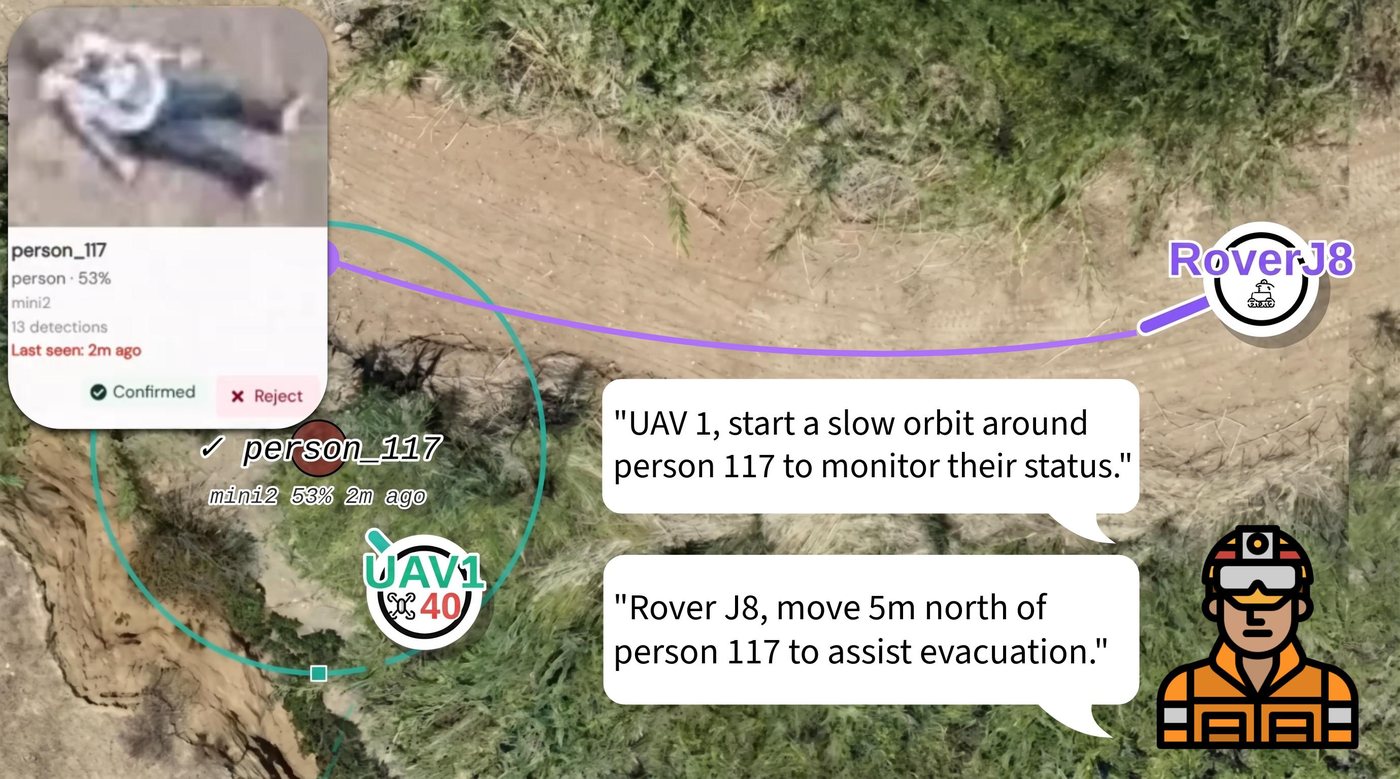
Once the operator confirms a candidate, the victim becomes a shared mission target that can be referenced in follow-up natural-language commands — for example, commanding a UAV to orbit the victim for continued monitoring while the UGV is dispatched to a position 5 m north to assist with evacuation without driving directly over the person. Figure 5 shows this post-detection response.
Feedback from a professional firefighter
A professional firefighter from Benalmádena (Málaga) joined the field demonstration and gave direct operational feedback, supporting the relevance of sector-based search, persistent no-go areas, human confirmation, and emergency pause and return commands that bypass the language model for SAR-oriented multi-robot deployment.
One Operator, Many Robots: Natural-Language Command of UAV–UGV Teams for Search, Victim Detection, and Rescue
Jarabo-Peñas, Bravo-Arrabal, Rolland, Christensen · Accepted at IEEE SSRR 2026